The Eastaff Map
The Eastaff map of 1806 includes this land, and shows its location relative to the Fort Townshend powder house.
Grant Registry Maps
There are also relevant maps in the grant registry, which I have not yet examined.
Insurance Maps
PANL microfilm copies, reel E-8-5. Some of the originals, with colour-coding not visible on the microfilm, are in the city archives. 1880 and 1893 in city archive. The Noad map of 1849/1852 does not include the area where the house is.
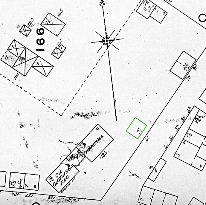
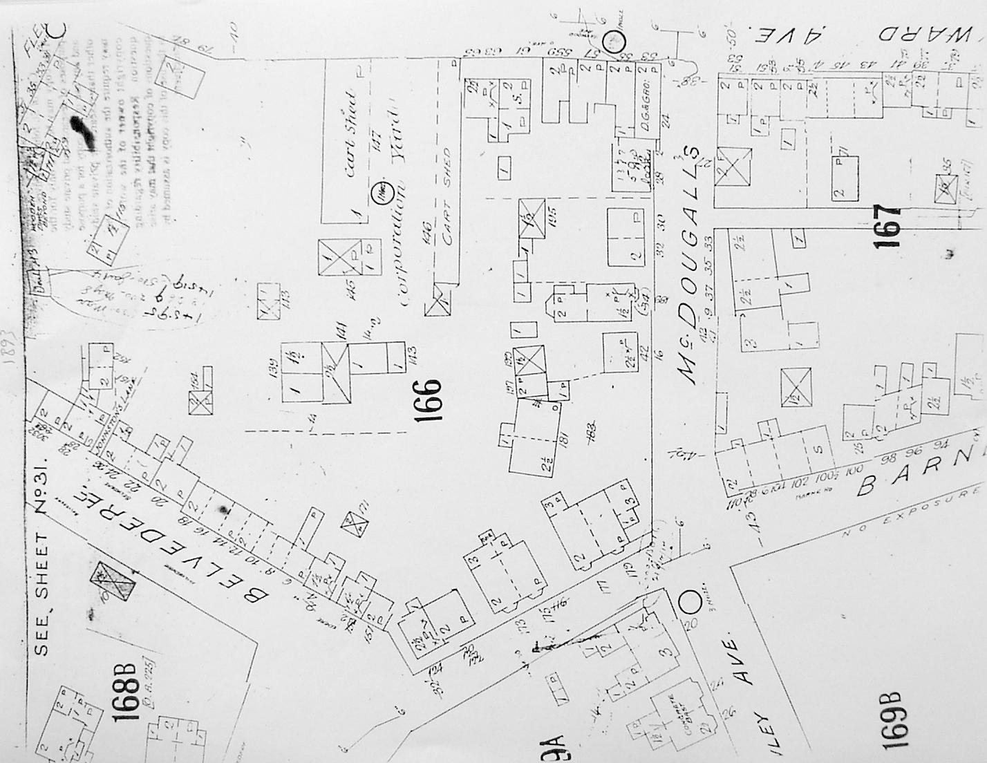
1880 map, and revised copy 1889
Page 22. The house is indicated as a typical wooden dwelling, 2 1/2 stories, with a wooden shingle roof and no openings on the side. approx. 30' wide by 26' deep. No land boundaries are indicated. The street is not named, but street numbers appear to continue from Maxse St. Mine is 42. The only other structures on the street are a big building where Lois's is, but more forwards, and extending all the way to Barnes Rd - about three times the size of the current double-house. There's also another 2 1/2 story at No.s 26-28, which doesn't appear to exist now. There's a cluster of small stables on the far side of the (current) parking lot, and two attached houses on Hayward that are prob. the farthest ones north now. On the other side of the street there's the three opposite as now (marked 3, 2 1/2, 2 1/2), the row houses on Barnes with no extensions, and a one-story building bordering the street for about 40 feet (~15 feet deep) in what is now the garden of the corner house on Barnes.
Detail. See also larger map
1893 map
Page 22. See next entry.
Detail. See also larger map
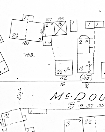
1893 map, revised 1902
Title page says city population is 30,000. Page 22. The street is called "McDougall's". There's a lot of new buildings: long stables and cart sheds stretching from behind the east side of the "parking lot cluster" over what is now the basketball court to Hayward. All the other Hayward St. buildings now in this block seem to be there as well 14 McDougall and the duplex east of it. The huge building going from 20 to Barnes Rd. is gone, and #20 is there, looking like it does now, apparently. First and third story windows are noted on the east side of 20, though it's indicated as a 2 1/2 story with a slate roof. They only seem to note windows on the sides of buildings where they often aren't normally at this time. Immediately next to #20 is a 2-story with a composition roof that's half in what's now my garden, with an adjoining 1 1/2 story stable entirely in my garden. Attached to and in front of the half of the two story is a small (~12 foot square) composition roof one-story, pretty much adjoining #20. A boundary or fence is marked in from the corner of that to the corner of my house, along the current boundary. At the very back of the (current) leasehold strip of my land is a one-story bldg, about 10'w x 18' deep. At the far end of #14 is a small one-story, attached to two others at the back of #10-12, in turn attached to a 1 1/2 story large shed at the far corner of #10. #14 is listed as 1 1/2 story, with a two-story extension. My house is listed as 2 1/2 story with a shingled mansard on the front, and a composition roof. I.e., as it is now.
1914 map
Page 22. #18 is added, same design as in 2000. The little one-story on that property is gone. Either the one and two-story bldgs at the back are replaced by similar slightly smaller bldgs, or the property line actually angled back to the middle of what is now #18.
1925 map
Page 22. #14 front part is changed to current 2-story mansard design. A big stable has been built on the city land behind mine.
1946 map
City population 45,000. Page 34. One-story back porch added to my house. Buildings along back of mine and #18 gone, replaced by structure with 1 1/2 stories in middle, 1 story on either side, attached to #20, going along entire back of #16 and #18, about 13' deep.
1963 map
Page 34. Structure at back now marked "Autos".